Introduction
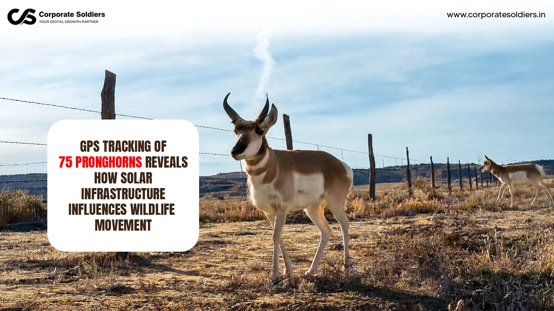
In one of the most comprehensive wildlife-tracking projects to date in the American Southwest, researchers fitted 75 female pronghorn with GPS collars in 2024 with the aim of learning more about how large-scale solar energy development impacts animal movement across open lands in New Mexico. Ever since, the animals have been relaying constant data on their location, which gave scientists an unmatched insight into how one of the most iconic migratory mammals of North America copes with a fast-evolving environment.
The project, spearheaded by conservation group Wildlands Network along the San Juan Solar and Storage Project outside Farmington, New Mexico, has gained attention as it lies at the nexus of two key environmental concerns: the need to rapidly roll out renewable energy and the need to protect wildlife migration paths. Initial findings indicate that infrastructure related to solar facilities, especially perimeter fencing, could affect the movement of pronghorn across landscapes that pronghorn populations have used for generations.
The study provides useful evidence to conservation scientists, land managers, and policymakers regarding how clean-energy projects can be planned to minimize biodiversity impacts and climate goals.
Why Pronghorns Matter
One of the most unique mammals that can be found in North America is the pronghorn ( Antilocapra americana ). The species is commonly confused with an antelope, but is not an antelope and is the only extant species in an ancient evolutionary lineage distinct to the continent.
Pronghorn are also known to be the fastest terrestrial creatures in the Americas. They can run at high speeds, and can go up to about 55 miles per hour (88 km/h) and this capability is believed to have developed as a response to predators that have since died out during the Ice Age. Their great stamina enables them to cover long distances through grasslands, shrublands and semi arid ecosystems.
Pronghorn do not only have a significant ecological role but also are exceptionally fast. They play a central role in the western North American ecosystems as herbivores that have a role in vegetation dynamics and have been used as indicators of habitat health. They are also a useful species to study landscape connectivity and ecosystem resilience, due to their seasonal movements.
Several pronghorn populations have seasonal migrations, which involve the movement of several pronghorns between breeding areas, feeding areas, and winter habitat. These migrations tend to take the pathways, which had been traveled centuries or even millennia ago. Since most species usually crawl and do not cross barriers, obstacles of even moderate size can have a considerable impact on movement behaviors.
This vulnerability to landscape fragmentation makes pronghorn a valuable center of migration study and wildlife protection activities.
The GPS Tracking Project
In an effort to obtain finer details on how these animals cope with the changing environment, a holistic project of monitoring was initiated by scientists around Farmington, New Mexico.
The Subjects: The study tracked 75 female pronghorns living in the area surrounding the San Juan Solar and Storage Project near Farmington, New Mexico.
The Timeline: It started deploying in 2024, with highly advanced GPS collars that are programmed to record the exact position of each animal every hour.
The Scale: The collars had recorded more than 700,000 location points by early 2025. This abundant data enables researchers to conduct spatial analyses of movement patterns and infrastructure interactions.
The geographical scope of this paper is the region around San Juan Solar and Storage Project- an 1,100-acre solar power project constructed next to an old coal-powered power plant. Such a shift to renewables out of fossil fuels can serve as a prime example of contemporary climate adaptation, and therefore serve as the ideal location to test sustainable co-existence.
What the Data Revealed
The GPS data has already started to show the interaction of the pronghorn with renewable-energy infrastructure and the environment.
Among the most obvious results is that fencing that is related to solar facilities can be a considerable barrier to movement. Pronghorn will normally seek to go under fences as opposed to jumping over them like the deer and other ungulates do on a regular basis. This is a behavioral trait that renders tall chain-link fencing an issue.
The researchers discovered that the San Juan solar facility has gaps in between the fenced areas, which are not necessarily in the pathways that the animals follow naturally. Consequently, certain movement tracks seem to be disrupted or changed.
The statistics also showed the movement of animals through the complicated pattern of the solar development. The fact that the project is composed of several fenced arrays, which are divided by roadways, washes, and privately held parcels, has provided researchers with an opportunity to examine the preferences of pronghorn in selecting between the available passageways and the effects of landscape characteristics on the choice of movement.
The other valuable point is the one of the past scientific work that the researchers refer to. Past research in Wyoming revealed the pronghorn activity to be lower around solar developments and the impacts were not confined to the nearby fenced area. These results can be used to give important background to the New Mexico data and to learn more about the way in which wildlife in general reacts to infrastructure.
Although the study is still in progress, an emergent pattern seems to be that movement behaviors can be designed not just by the physical existence of renewable-energy installations but also by the way related infrastructure is designed and positioned.
Why This Research Matters
This project is far more important than just one species or one solar installation.
Conservation of wildlife migration routes has emerged as a key conservation issue across the globe. With the growing discontinuity of the landscapes caused by road networks, urban sprawl, energy infrastructure, and other projects, migratory species are encountering mounting difficulties in their ability to find seasonal habitat.
The pronghorn experiment shows that GPS collars can be used to determine particular places where there are barriers to movement. This data is used by conservation planners to develop mitigation strategies that maintain connectivity and also allows development to take place where it is needed.
The results are especially important in terms of preserving habitats since in many cases, migration patterns link two or more ecosystems. When these are disturbed, animals can be deprived of feeding fields, breeding areas or important wintering grounds.
Climate adaptation also has implications on the research. With change in the environmental conditions, most wildlife species will require flexibility to traverse across the landscapes in search of appropriate habitat. Ecological connectivity is increasingly considered as a pillar of the resilience of biodiversity.
Also, the knowledge of wildlife movement can be used to reduce the human-wildlife conflicts, which can be done through how the infrastructure should be laid and how land-use decisions should be made, before conflicts start.
The study does not focus on renewable energy and conservation being opposing goals, but rather offers a possibility to combine the two goals using science-based planning.
The Role of Technology in Wildlife Conservation
The project demonstrates how conservation technology is revolutionizing ecological studies.
GPS telemetry enables the researchers to gather high-quality, almost real-time geographic data of animals that spans a big geographic zone. GPS tracking is able to record continuous information throughout a day and season unlike the traditional field observations.
Contemporary wildlife ecology and monitoring typically integrate various technologies and include:
- GPS telemetry systems
- Satellite communications
- Geographic Information Systems (GIS).
- Remote sensing data
- Landscape modeling tools
- Advanced spatial analytics
All these technologies assist scientists to learn about the migration paths, habitat occupancy, survival strategy, and reaction to the change in the environment.
Subtle trends in behavior can be identified using large datasets produced by GPS tracking of wildlife in ways that would be hard or impossible to discern using direct observation alone. They are also able to offer evidence that is objective and can be used to inform environmental assessment, conservation planning and infrastructure design.
Along with the ongoing advancement of tracking technology, scientists are acquiring more and more detailed information on the interaction of wildlife with both the natural and man-made environment.
Challenges Scientists Face
Wildlife tracking is a complicated task in spite of technological development.
Wild animals are difficult to capture and collar and need special skills and animal-welfare standards. Scientists have a dilemma between the importance of collecting necessary data and the reduction of stress and disruption to the research animals.
There are also environmental conditions that pose a challenge. Field work and equipment performance can be impacted by weather conditions, rough surfaces and isolated areas.
Another consideration is the quality of data. GPS systems are prone to signal limitation, terrain and error in measurements, which need to be validated and analysed carefully.
The long-term monitoring projects also necessitate permanent funding, technical assistance, and coordination of researchers, conservation agencies, government bodies and land managers.
Also, researchers should make sure that tracking equipment is lightweight, dependable and without hazards to the animals that carry them. The design of collar and battery efficiency have greatly enhanced the efficacy of wildlife telemetry, though equipment constraints continue to feature as a key consideration in the study design.
Future Implications
The potential of the New Mexico pronghorn study is that the research could lead to evidence based conservation and development programs.
Researchers hope that the information will assist them in coming up with viable solutions that will enable renewable-energy projects to coexist with wildlife movement. One suggestion already developed out of the study is the alteration in the design of fences to ensure that pronghorn can easily go under the fence and at the same time, the facility is not compromised.
The results can also underpin subsequent conservation policies that aim at protecting migration corridors and landscape connectivity. Land managers can focus their conservation or rehabilitation efforts on areas that will most benefit the ecology, by recognizing the common paths of travel.
Beyond that, the research is part of an increasing body of migration research aimed at comprehending the behavior of wildlife in response to the growing human infrastructure. This sort of knowledge is becoming more critical as countries seek biodiversity conservation objectives as well as large-scale renewable-energy.
The results of this project may also be used in future ecological research studies on habitat choice, behavioral change and species resistance to shifting conditions.
Final Thoughts
The GPS-collaring of 75 female pronghorn in New Mexico represents far more than a wildlife-tracking exercise. It is a large-scale conservation research initiative that provides rare insight into how one of North America’s most iconic migratory mammals navigates landscapes undergoing rapid transformation.
By collecting hundreds of thousands of location records, scientists have begun to uncover how infrastructure associated with renewable-energy projects can influence animal movement, particularly through the placement and design of fences. At the same time, the research demonstrates how relatively targeted modifications may help reduce ecological impacts while supporting clean-energy objectives.
The study underscores the growing importance of long-term wildlife monitoring in conservation science. As pressures from development, habitat fragmentation, and climate change continue to reshape ecosystems, technologies such as GPS collars are becoming indispensable tools for understanding and protecting biodiversity.
For pronghorn and countless other migratory species, safeguarding movement corridors may prove just as important as protecting habitat itself. The lessons emerging from this research illustrate how science, technology, and thoughtful planning can work together to ensure that wildlife remains connected to the landscapes on which its survival depends.